This post is based on a talk I delivered at the Dhuluny Conference at Charles Sturt University in August 2024. Dhuluny (pronounced Dhu-loin) was a series of truth-telling events commemorating the 200th anniversary of the declaration of martial law in the Bathurst region in August 1824. The declaration was in response to resistance warfare by Wiradyuri people that I explore in detail in the book Gudyarra: The First Wiradyuri War of Resistance – The Bathurst War 1822-1824.
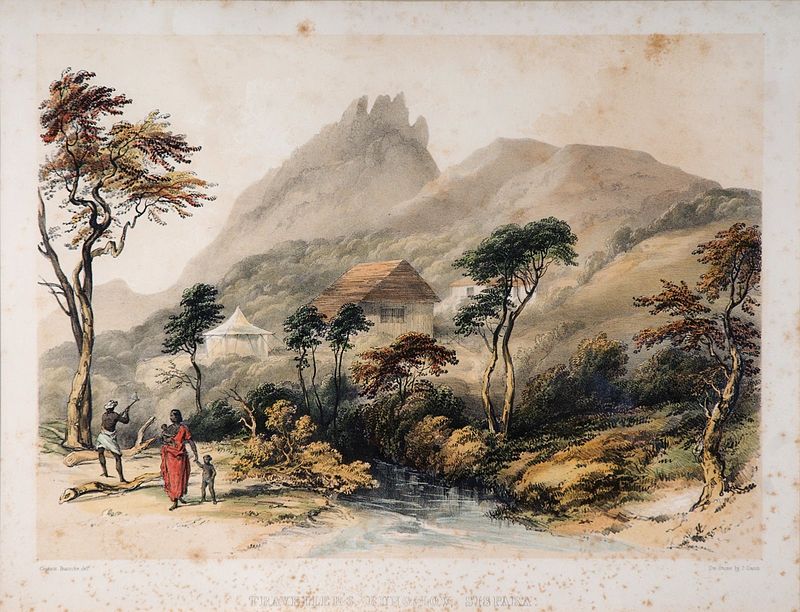
‘Country of very great Fertility’
When the Deputy Surveyor of Lands of the Colony of New South Wales George William Evans returned to Sydney in early 1814 from a trip across the Blue Mountains he was most enthusiastic about what he called the Bathurst Plains. It was such important country he believed it deserved important names – Lord Bathurst was the British Secretary for War and the Colonies. The King of England and Governor Macquarie also had plains named after them, and Queen Charlotte a sweeping valley.
Evans was much impressed with the fishing as well. While the grasslands were promising and there were kangaroos and other ‘game in abundance’, Evans wrote in his journal; ‘Nothing astonished me more than the amazing large Fish that are caught.’ The abundance of fish was a sure sign this was a ‘Country of very great Fertility’, as Governor Macquarie was to note. For a colony that had been hemmed in by the ring of mountains around Sydney for over 20 years, this was most important news.
Surveyor Evans had entered the northeastern edge of the great Wiradyuri nation. Wiradyuri Country extended through the Central West and far to the southwest. It is often called the ‘Country of three rivers’ – the Bila Wambuul (Macquarie), Galari (Lachlan) and the Marrambidya (Murrumbidgee). Over 10,000 people had lived here for tens of thousands of years. They were the ones who had farmed and tended the plains and managed the fish stocks. The early Europeans such as Evans thought it was a natural landscape – they had no idea of how Wiradyuri cared for their Country, how these ‘fine plains’ were tended by fire management practices, how rivers were cared for, how fields of yams and other plants were farmed. The colonists only saw fine grazing lands for sheep and cattle.
At first, the colonists were welcomed. They brought with them new goods. They were only a handful of people – between 100 to 300 colonists for the first few years, mostly convicts confined to the settlement. The tiny township of Bathurst was a mere pin prick inside the vast Wiradyuri nation. When Governor Lachlan Macquarie toured the Bathurst Plains in 1815 he met with several people who were very curious to see the Governor and his entourage. Among them was a young warrior named Wiinymaldhaany (Wiindhuraydhine, or Windradyne, ‘Fire-maker’). Windradyne, as he is widely known today, was to have a prominent role to play in coming years.
After seeing Wiradyuri Country for himself, the Governor ordered a settlement established. At first, he attempted to limit the expansion of the overstretched colony, but pressure soon grew from settlers keen to take sheep and cattle across to the grasslands.
The Governor well knew the importance of Bathurst to the ‘future prosperity of the Country’. When conflict broke out with Aboriginal people in the Sydney region between 1814 and 1816, Governor Macquarie ordered the largest military campaign then seen in the colony. Three strong detachments of infantry roamed the Nepean River and southern region of Dharawal and Gandangarra Country, before crushing Aboriginal resistance at the Appin Massacre in April 1816.
Importantly, Macquarie also ordered a strong detachment to guard the road to Bathurst. Sergeant Jeremiah Murphy was ordered out with a detachment of soldiers to defend the road and escort all government movements across it. When a government provision depot at Glenroy was attacked, Murphy was sent there at once. Sergeant Murphy, with a corporal and fifteen privates was instructed to establish garrisons at Blaxland, Springwood, near Blackheath and on the Cox’s River. They were to ‘afford protection’ to the government stock and ‘keep open communication’ between Sydney and Bathurst. If they met any warriors, Murphy was given orders ‘to fire upon them and take as many prisoners’ as he could.
For a brief period, today’s Great Western Highway across the Blue Mountains was a military road. When the resistance around Sydney had been quashed, the garrisons remained stationed along the road for several years after. The Governor had kept the thin line of communication with the important settlement at Bathurst open.
From 1815 to 1821, the tiny settlement of Bathurst had posed little threat to the lands and waters of the vast Wiradyuri nation. As Wiradyuri Elder Aunty Mary Coe notef in her book Windradyne – A Wiradjuri Koorie, ‘as long as the whites did not interfere in their lives they [Wiradyuri] would be prepared to share part of the land with them as they had always shared and exchanged with people who were guests on their lands.’ But now, settlers desperately wanted to send their sheep and cattle across the mountains. In late 1819 Commissioner John Thomas Bigge was sent to inquire into Governor Macquarie’s policies. Bigge strongly recommended opening up the ‘New Country’ west of the Blue Mountains to further settlement. In November 1821 governor Sir Thomas Brisbane followed directions from Bigge’s report and offered 200 ‘tickets of occupation.’ Within three years the Brisbane administration had granted such tickets or leases to over 100,000 acres of Wiradyuri land.
Soon, the colonists whose names adorn the street signs of Bathurst today began to arrive; Ranken, Hawkins, Street, Icely, Stewart, Piper, Steel and Wall. When George Ranken emigrated to New South Wales he was advised to direct his attention toward sheep farming. It was good, profitable advice. By April 1822 Ranken had fixed upon his intention to ‘take a run [sheep station] beyond the Blue Mountains’ as the country there ‘pleased him so much.’ George could hardly have predicted that within two years he would be defending his ‘run’ as part of a military column in pursuit of people he described as ‘enemies’.
By early 1822, conflict across the Bathurst region was escalating. The Commandant of the settlement William Lawson had an outstation at ‘Dirty Swamp’ near present-day Locksley. In March, Lawson’s hut-keeper William Mowbray was killed and a stockworker Charles Hatt wounded. Lawson believed his men had provoked the attack and he didn’t pursue the matter. But an uneasy situation had developed around Bathurst. There had been few instances of conflict since 1815. Now, there had been several attacks and growing numbers of sheep and cattle were being speared.
‘The stockmen hunt them and the cattle and sheep supplant them.’
Between 1821 and 1825 the number of cattle in the district increased from around 6,000 to 22,000. Sheep numbers rose form 27,000 to an incredible 92,000. In 1822 alone, sheep increased by ten thousand lambs. So too, people were arriving in Bathurst in numbers – between 1822 and 1823 the white population increased from 392 to 708.
In October 1822, one of the colony’s leading officials, Judge Barron Field, could see an impending crisis – there were no kangaroos to be seen anywhere near Bathurst. As he said, ‘the stockmen hunt them and the cattle and sheep supplant them.’ He noted that all that was left for the Wiradyuri were possums and fish. By 1823, for Wiradyuri people, the choice between continuing to try and find ways to live with this new world, or resisting it, was becoming starker.
Conflict erupted in a series of raids and skirmishes across the entire Central West region. As occurred right across the Australian Frontier Wars, warriors began what the Europeans understood as guerilla war. This involved attacking the colonists’ sheep and cattle and targeting stockmen on the isolated sheep runs and outstations.
The fertile Kings Plains area to the south of Bathurst was a meeting place along the route travelled by many Wiradjuri and other groups coming from the south towards the Bathurst Plains for ceremonial and food-sharing events. The route ultimately led to the Southern Alps, with Aboriginal people travelling hundreds of kilometres to feast on the bogong moths that migrated there each year.
Around the spring-fed headwaters of the Belubula River, combined hunting parties herded kangaroo with grass fires, and women netted the birds that were attracted to the permanent water supply. The Belubula springs area is still recognised today by Wiradjuri people today as an important site.
In August 1823, at John Wylde’s ‘further Station’ at Kings Plains, stockman Henry Alsop was armed but alone in a hut when, according to Wylde’s overseer Andrew Dunn, a group of Wiradjuri approached. They suddenly attacked Alsop, who was ‘cut in a most shocking manner’. Then, ‘one of the natives got the loaded Gun, which was discharged’. After a ‘general severe affray’ two more stockmen turned up and when ‘one of the blacks was shot dead on the spot’ the rest retreated.
The stockworkers were spooked. They ‘deserted the station altogether the better to defend themselves.’ According to overseer Dunn, the men expected two or three hundred warriors ‘to come down upon them and kill every one of them’.
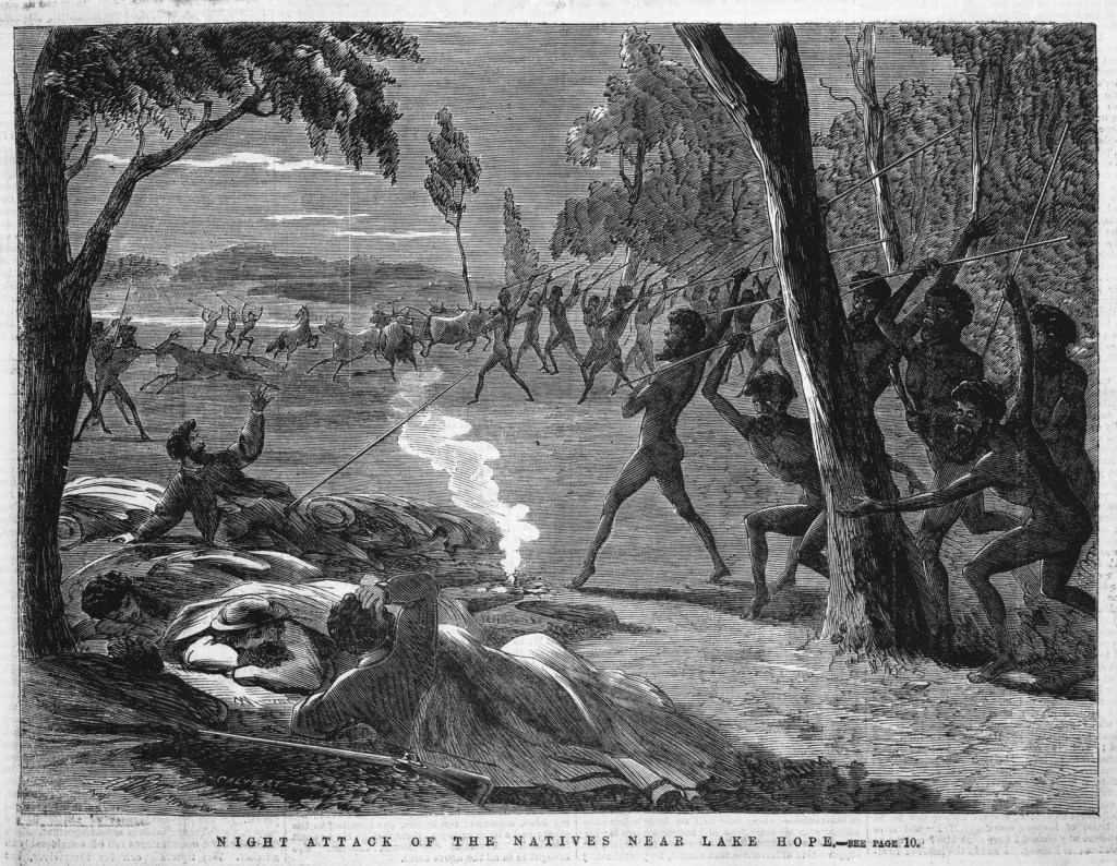
Image: Night attack of the native near Lake Hope, Ebenezer and David Syme, Melbourne, 1866, State Library of Victoria.
‘Murra gerund white fellows’
The Wiradyuri were certainly on the offensive. Stockman Henry Alsop reported that when he saw ‘a number of natives a little distance off’ they ‘shouted out “murra gerund white fellows”’. Alsop was with a Wiradyuri man known as ‘Scrammy’ who would have been able to translate this to him as ‘tumble down (die or kill) white fellows.’
The message to the Europeans was now clear – the Wiradjuri wanted to destroy not just cattle and sheep, but white men too. In November 1823, Wiradjuri attacks had effectively stalled the expansion of the government stock stations and had forced the abandonment of others. Stockmen were, as William Lawson wrote, ‘intimidated and would not leave their huts to round up the cattle and bring them in without protection’.
Warriors around Kings Plains were gathering in numbers. Overseer Dunn reported that ‘the land is covered with them and they are so pent for war that the men are obliged to stay in the huts to save their lives’. Right across the outstations to the southwest of Bathurst, by late 1823, Wiradjuri people had reasserted control over their lands.
In 1824, Wiradjuri tactics shifted to a new level of aggression. Threats to ‘tumble down white man’ were carried out in a series of raids and attacks. William Lawson noted how suddenly, people stopped coming into the township and broke off all contact with the Europeans. It was clear that total war or gudyarra, had been declared.
Gudyarra (war) on the Bathurst Plains
Two events may have pushed the Wiradyuri into all out war. At what was later known as ‘Murdering Hut’, poisoned damper was left out for Wiradyuri people. Closer to town, on the fields of ex-convict Antonio Roderigo that once grew murrnong or native yams and now grew potatoes, a number of people were gunned down. When a group of Wiradyuri decided to take some potatoes without Roderigo’s permission, he ‘roused the people of the settlement [and] they rushed down and attacked the blacks, some of whom were killed and others maimed.’ Simply for taking potatoes.
The people who died in the Bathurst Massacre were some of the young warrior Windradyne’s family. In late May, Windradyne led a rampage of death and destruction across the north of Bathurst. At the stations ‘Mill Post’, ‘Warren-Gunyah’ and ‘Millah-Murrah’, Windradyne and his warriors burnt down huts, destroyed stock, took firearms, and killed several station workers.
In coordinated attacks across the region, to the south of Bathurst on O’Connell Plains, more stockmen were killed and hundreds of sheep speared, driven off and captured. We can only imagine the terror setting in. To add to this, in early June, the townspeople of Bathurst watched a cart trundle down the main street piled high with the bodies of seven dead white men.
It was at this point, people at Bathurst turned to their own kind of warfare. As ex-sergeant Tom Miller later recalled, he ‘received orders to form a party to hunt down the blacks.’ With ‘about twenty men’, Miller said he ‘went out and shot and killed any they came across, little and big, young and old shared the same fate.’
We know few other details about how these massacre parties went about their work. One such killing spree at ‘8 mile swamp’ on the O’Connell Road was investigated and Commandant James Morriset sent five men to Sydney for trial. But no one was found guilty for the killing of three defenceless Wiradyuri women.

Image: Pencil Sketch by Thomas Domville-Taylor, from the Patty Ffoulkes Scrapbook, 1840-1844, National Library of Australia. This is a rare first-hand sketch of an attack by armed settlers on Aboriginal people.
‘Destroy the natives before them’
By July 1824, 13 white men had been killed. We can only estimate the number of Wiradyuri people who had died – one of the few humane settlers in the district George Suttor believed ‘at least 70’. This was irrelevant to the pastoralist and graziers in Sydney whose flocks and herds were being decimated and whose stockmen were being killed and refusing to work. They demanded action.
One of the most vocal was William Cox. The famous Blue Mountains road builder now turned wealthy pastoralist called for a huge extended line of soldiers and armed men to sweep across the entire region and ‘destroy the natives before them.’ While this didn’t happen, it was famously later resorted to in Tasmania in 1830 – later known as the ‘Black Line.’
Governor Brisbane was under intense pressure. The new economic heart of the entire colony – sheep grazing – was under threat as warriors continued to press their attacks across the region. The Sydney Gazette newspaper reported that they appeared to be ‘combining together and moving in larger numbers’ and in one skirmish were in fact left ‘the masters of the battlefield.’
A voice of reason was the Attorney General Saxe Bannister. He asked how the colonists ‘could approve of their own conduct, in having first invaded their [Wiradyuri] land and deprived them of their subsistence?’ Bannister believed that ‘no difference existed between individuals, whether black or white’ and the same laws applied equally. Remarkably, he even called for a halt to the colonisation of Aboriginal lands and to make ‘reparations.’
But his was a voice in the wind. The colonists demanded military action. On August 14 1824, what Bannister thought would be a compromise, was announced – a declaration of martial law west of the Blue Mountains. Perhaps, as Bannister later wrote, this would control the bloodshed on both sides of the conflict. Bannister later said that it was he who convinced Governor Brisbane to choose martial law as a way to placate the pastoralists, make a show of force against the Wiradyuri, and control the settler reprisal killings. It remains unclear which if any of these martial law actually achieved.

Image: The Governor attending the annual meeting of the First Australians at Parramatta, New South Wales, Augustus Earle, c. 1826, National Library of Australia
‘To make a general peace’
The military garrison at Bathurst was reinforced and Major Morriset headed up three columns of soldiers in a vast sweep of country around Bathurst. While they found no warriors, the attacks soon ceased. A powerful show of military force seems to have done the trick. Whether after the declaration of martial law the settlers such as Tom Miller were still operating their massacre parties is unclear. The Gazette newspaper noted in October that ‘Bathurst is engaged in an exterminating war.’ By November however, the Governor could report the region was quiet.
In December, Windradyne had not been defeated, but the situation had become impossible. He led a large group of Wiradyuri to the Governor’s annual feast for Aboriginal people at Parramatta, as Saxe Bannister said ‘to make a general peace.’ The Wiradyuri received food and blankets and were allowed to return to their homelands unmolested. No treaty was signed, no agreement made. The colonists merely picked up from where they had left off and continued to take more and more Wiradyuri Country for grazing their sheep and cattle.
The threat to Bathurst was over. But the fact that colonists at Bathurst resorted to massacres highlights their fear and desperation. We must not forget that, as the eminent late historian Lyndall Ryan noted, ‘the act of massacre is not so much an expression of power by a strong regime or a strong group of people, but an expression of a position of weakness.’
And we must not forget the widespread, coordinated and incredibly skilful resistance conducted by Wiradyuri people against the colonial juggernaut of sheep, cattle, horses and armed men that was rolling across their Country. They dug in deep, hit the colonists hard and frightened them into tactics of shock, awe and terror. Windradyne led them, undefeated, to obtain some kind of peace settlement. This is the kind of heroic resistance that needs equal commemoration alongside Australia’s other wars.
Yindyamarra
I pay thanks and my respects to the Bathurst Elders, in particular Uncle Yanha, Aunty Wirribi and Uncle Dinawan. I thank them for the invitation to talk at the Dhuluny Conference in August 2024 and for their guidance over recent years in writing about these difficult but important histories.
References and sources for this post can be found in the book Gudyarra: The First Wiradyuri War of Resistance – The Bathurst War 1822-1824.