A thin red line across the Blue Mountains: Governor Macquarie and the military campaigns of 1816

For two violent years between 1814 and 1816 the so-called ‘Wild Mountains Natives’, mostly Gandangarra people, were seen by the Sydney colonists as a major threat. Their raids on the fringes of the Cumberland Plain were regular and at times deadly. There were reports they would ally with the Dharawal warriors and attack the settlements, and ‘murder all the white people before them’. Gandangarra warriors had been seen in warbands of several hundred and settlers had been forced to flee outlying farms for the safety of townships.

After the Battle at Razorback in March 1816 where a scratch militia force under the command of the Bringelly Magistrate Robert Lowe had been defeated in open battle, and after increasing numbers of settlers’ deaths at the hands of warriors, Governor Lachlan Macquarie decided to act.

Historians have long emphasised the fact that Macquarie was the first Governor of New South Wales who had an army rather than navy background, and have seen this as part of his methodical and clinical approach to the sweeping campaigns of 1816, designed to ‘Strike them (Sydney Aboriginal people) with Terror’. But what particular military experience did Macquarie bring to the colony? And did this have any bearing on what was essentially guerrilla warfare in 1816? There has been little attention paid to the influence Macquarie’s field and campaign experience may have had on warfare in the Sydney region and there has been no real interrogation of his – and others in his circle – motivations for the largest military campaign in the early colony.

An old soldier

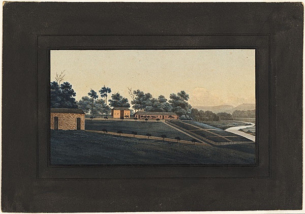
Before the dire situation of 1816, Macquarie had travelled by coach and horses across the Blue Mountains to inspect the ‘New Discovered Country’ of the Wiradjuri lands around Bathurst. In his journal and his reports back to the authorities in England he waxed lyrical about the grasslands of the Bathurst Plains. This ‘rich, fertile country’ was, he believed, critical to the expansion of the colony beyond the Sydney basin that it had been trapped in for so long.

So Macquarie certainly had a good first-hand knowledge of the long and isolated route of William Cox’s newly built road over the mountains, and would have well understood its vulnerabilities. Perhaps he was reminded of the road from the Malabar Cost to Mysore in India. This road up and over the Western Ghats via the Poodicherum Pass was a significant physical challenge (and remains so today, popular with trekkers and mountain bikers). Macquarie had traversed this road three times (in 1791, 1792 and 1799) and had also campaigned in the Western Ghats against the Pazhassi Raja (aka Kerala Varma) in 1797.

This campaign of guerrilla warfare prior to the defeat of Tipu Sultan had dragged on from 1793-1805. British forces stretched out along the narrow, jungle covered mountain roads were always vulnerable. The similarities between the new road across the rugged Blue Mountains and the road from the Malabar Coast to Mysore may well have influenced Macquarie’s decision in April 1816 to send a detachment under Sergeant Jeremiah Murphy to defend the road and escort all government movements across it. (The Sydney Wars, 243-4)

The Western Ghats in Kerala. ‘View to the west, of Sispara bungalow and Sispara peak across the stream in Sispara pass from the Sispara ghat trail’, Lithograph after Stephen Ponsonby Peacocke, 1847 (details)

By 1797 Macquarie had made his way through the ranks of the British Army in India to the position of Brevet Major. He had seen action in regular warfare at the siege of Cochin in 1795 and the capture of Colombo and Point de Galle in 1796. In April 1797 he heard news that Governor Jonathan Duncan and Lieutenant General Stuart were in Tellicherry preparing for a military campaign against the Pyché Rajah in the Cottiote region of the Malabar Coast. Macquarie immediately volunteered for active service and was given command of the Advance Guard of 700 men, made up of four companies of the 77th Regiment and a battalion of the 3rd Native Infantry Regiment. Macquarie recorded his experiences during the campaign for the three-week period from 3-22 May, 1797. On May 9 Macquarie led his Advance guard out from Kydree and as he wrote in his journal:

… we marched on for about an Hour, through very close Jungle, and occasionally through Batty Fields, without meeting with any molestation, until we entered a narrow Pass that led through remarkable thick Jungle and rough broken Ground full of Ravines, Rocks and Banks that afforded excellent cover for the Enemy. 

It was in this pass that the British ‘convoys were afterwards so severely attacked and annoyed by the Enemy’ and Macquarie went through several days of skirmishing with forces who were ‘no sooner Dislodged from one set of Rocks and Banks than they occupied others at a distance to annoy us from with this teasing and galling Fire’. Macquarie led his men in charging ‘the different Bodies of the enemy posted on the Heights and very soon put them to the Rout’, and he received a minor wound from a spent musket ball. Macquarie reflected on his experience of what he called an ‘extraordinary mode of warfare’ and noted how communication and supply route guard posts were established after the campaign in response to the fact that while ‘their Troops must now be fully sensible that they never can stand us in the Field’, the enemy could still easily cut British communications in narrow roads through mountain passes covered in dense jungle.

Western Ghats as seen from Gobichettipalayam, by Magentic Manifestations – Own work, CC BY-SA 3.0 (details)

An advantageous retreating ground

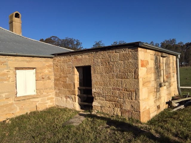
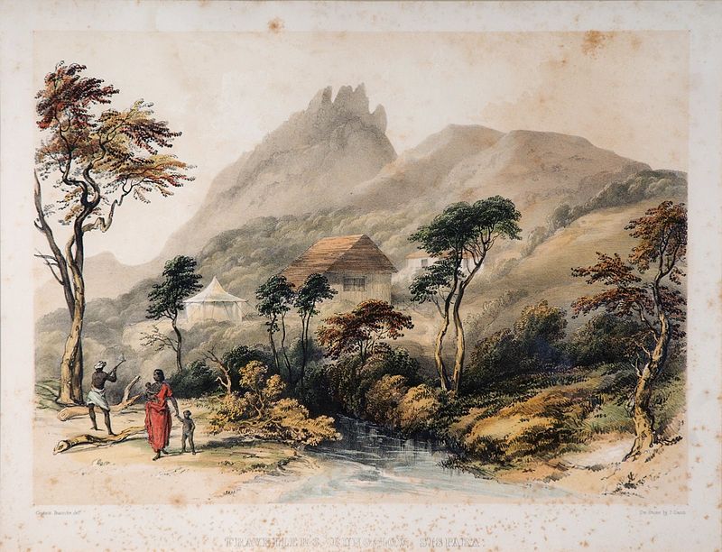
In Sydney between 1814 and 1816 an often repeated reason for the scourge of raids and attacks on outlying farms was that warriors could easily retreat into the rugged Blue Mountains after plundering farms of corn and livestock. The mountains were described by one early colonist as ‘advantageous retreating grounds’ where soldiers and armed parties could never hope to capture those responsible for these ‘depredations’.

In 1816, Macquarie and his military officers were obviously aware of this when they planned their campaign. Each detachment was to support the other and cover any warriors trying to escape into the mountains. Once the initial campaign was devised to sweep around the north, down the west and to the south of the Cumberland Plain, Macquarie added an important but often overlooked additional attachment to guard the Bathurst or Western Road.  

A map showing the extent of Macquarie’s 1816 campaign. The Sydney Wars, p 224

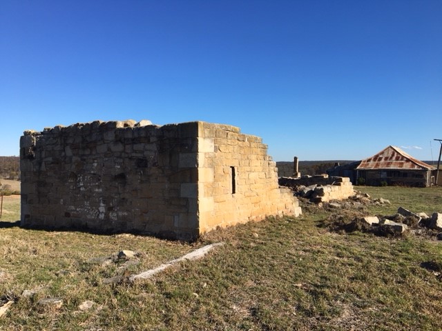
‘Celebrating’ the Appin Massacre

While Macquarie’s military experience should be highlighted, what of the other officers involved in the 1816 campaigns? Who else may have helped to shape Macquarie’s military thinking and planning? The officers directed to lead detachments in the campaigns also had direct military experience of campaigning in rough terrain. Captains James Wallis and William Schaw of the 46th Regiment had both served in the West Indies and campaigned in the defense of Dominica against the French in February 1805. Captain John Watts, Macquarie’s aide de camp, had served in the West Indies, firstly in the 64th Regiment, and later with the 46th Regiment in the capture of Guadeloupe from the French in 1810 and Captain John Gill (46th Regiment) probably also served in the West Indies.

There was a wealth of military experience surrounding Macquarie. Captain Henry Colden Antill, Macquarie’s Major of Brigade, served with the 73rd Regiment in India between 1798 and 1806 and earned promotion in the field during the storming of Seringapatam on 4 May 1799. And finally, Lieutenant Colonel Molle, commander of the 46th Regiment and Lieutenant Governor, certainly could have contributed to the planning of the 1816 campaign, although an increasing estrangement between Macquarie and Molle may have been at issue here.

This seating plan for a dinner party at Government House includes the senior military figures in the colony and officers involved in the 1816 campaign. It has been suggested that the dinner party may have been held to celebrate the recent safe return of the three detachments from campaigning on the Cumberland Plain – a campaign that included the massacre of 14 Aboriginal people, cutting off the heads of two and stringing their bodies from trees, and bringing women and children in as prisoners. ‘Table Plan for a Dinner Party at Government House.’ (Ca. 1815?) Macquarie Papers – Single Letters and Fragments 1801-1820 ML MSS 4199 Item 6

Macquarie researcher Robin Walsh raises other important questions about the 1816 campaign. What role did the Governor’s Secretary, ‘intimate friend and loyal supporter’ John Campbell play? Campbell was influential in shaping official policy during Macquarie’s governorship. He also had a vested interest in land near Bringelly on the fringes of the Sydney basin in 1816 with his Shancomore and Ballynashannon estates – both of which had been raided by warriors and plundered of stock and produce. Did he urge Macquarie to act? Campbell’s role in the military responses to the raids and attacks on the out-settlements in 1816 must be considered, as should his role in shaping the language of punishment by punitive expedition and any subsequent ‘reconciliation’ – his role as ‘official censor’ for the Sydney Gazette newspaper was in fact important in shaping the views of the entire colony.

The strategic significance of the Bathurst Road in Macquarie’s response to conflict with the Sydney people has been overlooked by a focus on the crossing of the Blue Mountains, the construction of the road, and the opening up of the ‘New Discovered Lands’. This teleological view of these histories has added to the erasure of the significance of Aboriginal resistance warfare in this period from broader historical memory (by non-Indigenous Australians at least).

The Gandangarra were perceived as the major threat in 1814-1816 and Macquarie almost certainly would have been aware of the similarities between this road and its’ vulnerabilities to attack in the same way that the road from the Malabar Coast to Mysore had been prior to the defeat of Tipu Sultan. The extent to which military officers in the early colony used their knowledge and experience of guerrilla warfare in places such as India and North America and adapted this to the specifics of Australian Frontier Wars, has only comparatively recently been of interest to military historians. From Captain Watkin Tench’s first use of what was to become a ubiquitous part of armed responses to Aboriginal resistance – the dawn raid – in 1790, to Macquarie’s thin red line across the Blue Mountains in 1816, there is much still to be uncovered about the impact of the British armed forces in Australia, and the significance of the threats they faced.

___

With thanks to Macquarie researcher Robin Walsh for insights into Macquarie’s military experience in India.

References

Lachlan and Elizabeth Macquarie Archive

https://www.mq.edu.au/macquarie-archive/lema/1797/1797may.html


Macquarie, Lachlan. Journal No. 3: 29 December 1794 – 27 September 1799. Mitchell Library, Sydney. ML Ref: A769 pp.225 – 260

Rifle slits and gun loops: Early colonial domestic defensive architecture in the Sydney region

The image above is of Beulah homestead, near Appin in southwest Sydney. It is important as a rare example of 1830s colonial architecture that is still in – at least for the moment before it is surrounded by new housing developments – a rural setting. But there is something intriguing about it. In an attached stone room at the rear there is a narrow window. It is carefully crafted from sandstone with a well-cut groove for an external wooden shutter. The aperture flares out at angles to create a wider window on the inside. It follows the classic features and dimensions of rifle slits – often also called loopholes, gun loops or musket loops. In the 400 odd pages of the heritage report on this historic homestead there are two words about the window; ‘possibly defensive?’.

The Vines granary 1

This image is of another stone outbuilding in the Appin area, at The Vines. It too has an embrasure, or opening in the style and dimensions of a rifle slit. In fact, I have now identified five similar features in buildings in just a few kilometres radius. It is possible, as several decades of Australian heritage studies of early colonial building have rather disinterestedly noted, that these loopholes were made for ventilation in granary structures, or were Georgian decorative features. But there is increasing circumstantial evidence at least that they may have been made for other reasons as well.

The first land grants of Dharawal land to settlers in the Appin area began in 1811. By 1816 there was a small settlement which grew throughout the 1820s. It is unclear exactly when these stone outbuildings were constructed – it seems to have been from the 1820s according to heritage studies – but it is known that outbuildings of stone were often the first structure of importance in frontier districts deep in Aboriginal land. So too, we know that in other colonies such as Jamaica, the British practice was to build domestic architecture with defensive elements. And we also know of hundreds of examples of rifle slits in frontier settings beyond Sydney.

At the height of Governor Lachlan Macquarie’s now infamous military campaigns of 1816 that resulted in the Appin Massacre there were reports of groups of several hundred Gandangarra and Dharawal warriors roaming the district, raiding farms and attacking settlers. Between 1814 and 1816, a significant period of resistance, guerrilla warfare occurred in the area. Just after a local militia force led by Magistrate Robert Lowe had been beaten in a battle at The Razorback, settlers in the area fled as refugees from a war zone to the safety of the main settlements.

Were some of these domestic defensive structures built at the height of this period of conflict? Or were they built later, with this warfare still fresh in settlers’ minds? Were they built, like many other examples of government, military and other buildings around Sydney, with several uses in mind at the same time – securing precious grain, as well as defence against convict uprisings, bushrangers and Aboriginal attacks?

The Vines granary
A closer view of the exterior of the outbuilding identified as a granary at The Vines, Appin.
The Vines slit ext
Interior view of the Vines granary slit window showing the thick wall and angled embrasure. A 2002 Heritage Report noted of this outbuilding on The Vines at Appin (on land granted to Moses and Michael Brennan in 1816) thatthe western wall has an unusual V-shaped slit half way up the wall. While this may be a ventilation slit, its position and width has led to local suggestion that it was a fortified structure and the opening is a loophole’. The NSW heritage listing for the site notes; ‘The ruin of the granary building at North Farm is unusual in that it appears to have a loophole or gun slit in the remaining section of the western wall. Although this can’t be proven, if it is evidence of a fortified agricultural building this would be rare in a State context.’

Heritage experts versus military historians

My first thoughts about these narrow windows was to err on the side of caution, and in line with heritage opinion. So I consulted an expert, who basically said that such embrasures were a normal feature of stone/brick granaries in the Anglo-European tradition. This heritage argument runs that the inner splay of the opening assists with air movement and as most of the embrasures in the Appin district are found in granaries or store rooms, and the cultural background of the property owners led to the use of traditional English building forms, whether appropriate or not, it seems they were distinctly agricultural in function and had nothing to do with defensive architecture.

So then I consulted a military historian and sent him pictures of the various slits in several buildings. He felt the buildings were ‘strong defensive structures of stone with gun slits built in. On the outside these would have been just narrow slits that were difficult to target with a spear, while on the inside the generous space allowed to traverse muskets meant that fire could be delivered with a wide arc …’

Blighton NGA
George William Evans, Blighton Farm, 1810, watercolour with drawing in pen and ink and brush and ink. National Gallery of Australia (NGA 94.1418) This watercolour shows Governor Bligh’s so-called ‘model farm’ on the Hawkesbury River at Pitt Town. As in many images of early colonial Sydney , on close inspection the granary has slit windows that may well have made the outbuilding a stronghold if required.

Fortified houses across the Empire

In other British colonies during the 18th century, domestic architecture, particularly in rural settings, almost always incorporated defensive elements. According to Louis Nelson’s study of architecture and empire in Jamaica, ‘the British colonial presence … was marked by a profound uncertainty, an unrelenting anxiety that found expression in their architecture.’ Fortified houses in Jamacia were built during a long period of guerrilla war in the countryside, and were often based upon Scottish border ‘tower houses’ or with a ‘bastion room’ (a stronghold) that would function daily as a normal room, but be well fitted with armaments and capable of military defence at a moment’s notice. Many of the loopholes doubled as ventilation holes.

Indeed, after a rebellion in 1760, ‘the following decade saw an intense period of fortified house construction that was based on fear and anxiety of past events, rather than any actual threat. It continued to shape architecture long after and into the 19th century’. Could the same be said of the 1820s across the out-settlements of Sydney? Were these rifle slits in some way referencing the history of Frontier War violence in the Appin district? (Nelson, 42-65)

Colonial fortifications

In a recent article ‘”Necessary Self-Defence?”: Pastoral control and Ngarrindjeri resistance at Waltowa Wetland, South Australia’, Wiltshire, Lister and Rigney note that research into the fortification of colonial buildings in Australia has advanced recently, but that much of this research is ‘marred by uncertainty, with the purpose [of the architecture] being difficult to discern in the absence of archival records, oral history or other signs of use’. They do note that there are rare instances of concrete evidence of explicit defensive arrangements often found in pastoral ‘reminiscences’. (Wiltshire et al., 102)

Interestingly, this overview of buildings in Ngarrindjeri country found a ‘stable/shearing house’ with rifle slit style apertures (50cm by 10cm) that were ‘a surprising 2m above the ground, possibly requiring a prop or step for their use’ and potentially higher for better distant views – very much like the openings at the Mount Gilead property outbuilding in Appin. They also note that the narrow windows ‘probably served as ventilation, common in the English ‘Bank Barn’ design, where installation would mitigate heat accumulated from grain storage’.  (Bell 1997; Grguric 2008, 71; Wiltshire et al, 103-4)

As in the Sydney region, it is almost impossible to know the precise date of the construction of the buildings and whether this aligns with periods of frontier violence. But as Wiltshire et al argue, even if these structures were built later than the frontier violence period and for non-defensive reasons, they have become part of the cultural memory around this violence, becoming reference points ‘that physically anchor cultural memories of frontier violence’ to certain places. And importantly, as Nicolas Grguric notes, ‘this architecture also constitutes material evidence of a vanguard of Australian colonisation (or invasion) being carried out, not by the military or police, but by civilian settlers.’

My work has been very much focused on the historical archive – the discursive structure of the colonial written record of warfare and conflict in early Sydney. But archives also exist as things, as places, occupied by people. The few surviving remnant landscapes and buildings around Sydney may tell us more than the architectural expression of early settlers’ aspirations and traditions, and something of their fears as well.

With thanks to Saul Dean of the Total Environment Centre for alerting me to these buildings, to Sue Gay for her insights, to historians Ray Kerkhove and Rodd Pratt, and to the helpful people at the Appin History Centre, especially Nola Douglass.

References

N K Grguric, (2008) ‘Fortified Homesteads: the architecture of fear in frontier South Australia and the Northern Territory, ca. 1847-1885’, Journal of Conflict Archaeology 4 (1-2):59-85

Grguric, Nicolas, (2007) Fortified Homesteads: The Architecture of Fear in Frontier South Australia and the Northern Territory, ca 1847-1885, Flinders University, School of Humanities

Louis P. Nelson, (2016) Architecture and Empire in Jamaica, Annie Burr Lewis Fund

Kelly D. Wiltshire, Mirani Lister and Grant Rigney, (2018) ‘”Necessary Self-Defence?”: Pastoral control and Ngarrindjeri resistance at Waltowa Wetland, South Australia’, Journal of the Anthropological Society of South Australia, Vol 42, December 2018, 81-114

Windmill Hill Group’ NSW Office of Environment and Heritage

‘SCA – Historic Appin Properties – Conservation Management Plan’, Godden McKay Logan, 2002